Office Address
- Department of Earth and Environmental Sciences IISER Campus, Knowledge city Sector 81, SAS Nagar (Mohali) P.O Manauli India. PIN 140306
- headees@iisermohali.ac.in
Dr. Yunus Ali is presently heading the Geomorphology of Mountains and Valleys Lab, Department of Earth and Environmental Sciences, at the Indian Institute of Science Education and Research, Mohali, as an Assistant Professor. His research specializes in geomorphology, remote sensing, machine learning and geographic information systems (GIS) to analyze natural hazards, particularly landslides and post-seismic landslide controls, river and coastal morphologies from local to regional and global scales. He also has a fond interest in the sediment and nutrient dynamics in surface water, lake water, and ocean interfaces. Dr. Yunus is a recipient of the Japanese Government Monbukagakusho Scholarship (MEXT). He was awarded doctoral degree from The University of Tokyo, Japan in 2014. Prior to joining IISER Mohali, he also served as Assistant Professor at Aligarh Muslim University in the Department of Geology, and postdoctoral researcher at the National Institute for Environmental Studies, Japan, and at the Graduate School of Frontier Science, The University of Tokyo. He also has working experience in premium research organizations like the State Key Laboratory for Geohazard Prevention and Geoenvironment Protection, China, and the Japan Agency for Marine-Earth Science and Technology. Dr. Yunus has published over 70 international scientific articles in reputed journals, and also serves as reviewer for numerous earth system science journals.
GoogleScholar: https://scholar.google.co.in/citations?user=l3WMApQAAAAJ&hl=en
ResearchGate: https://www.researchgate.net/profile/Ali-P-Yunus
Twitter: https://twitter.com/yunus_apy
Geom Lab: https://sites.google.com/view/geomlab/
Personal Webpage: https://sites.google.com/view/yunusp/

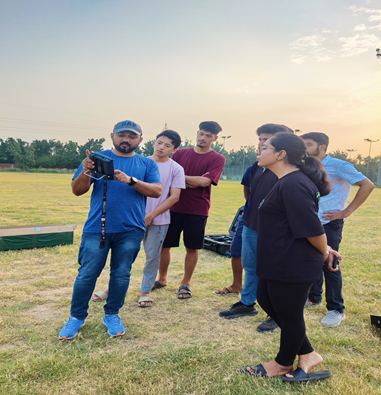
GEOM Lab (Geomorphology of Mountains and Valleys lab) focuses on understanding the evolving controls of co-seismic, post-seismic, and rainfall-induced landslides in different orogenic settings. We also aim to understand the mechanisms of large landslides and rock avalanches in glaciated environments under accelerated warming, and how they control the fluvial incision in the headwater streams. The geomorphic imprints of catastrophic landslides, their influence on sediment budgets at local and basin-wide scales, and ways to minimize vulnerability and risks are other key areas of our focus. For this, we integrate field, remote sensing, and laboratory analysis; and analyze big data using machine learning models. In our recent project, we aim to develop near-real-time early warning models to mitigate the landslide hazards in the Indian Himalayas by combining WRF model outputs with a comprehensive landslide database.
| Name | Role | Profile Photo |
|---|---|---|
| Sahil Kaushal | PhD Student |  |
| Shah Masud UI Islam | PhD Student |  |
| Jiyadh Thanveer VP | Project Assistant |  |
| Ajay Singh | MS Student |  |
| Satish Kumar Kumawat | MS Student |  |
| Arun Negi | MS Student |  |
| Aryan Dhansyan | MS Student |  |
| Devesh Sharma | MS Student |  |
| Yuvika Beetan | MS Student |  |
| Name | Photo |
|---|---|
| Unmanned Aerial Vehicle (2 Nos.) |  |
| LIDAR & RGB Camera |  |
| Thermal and RGB zoom Camera |  |
| NIR Camera |  |
| UV-Vis Spectrophotometer |  |
| Muffle Furnace |  |
| Laboratory Drying Oven |  |
Ongoing Projects: