Office Address

  • Department of Earth and Environmental Sciences IISER Campus, Knowledge city Sector 81, SAS Nagar (Mohali) P.O Manauli India. PIN 140306
  • headees@iisermohali.ac.in

Social List


Research


GEOM Lab (Geomorphology of Mountains and Valleys lab) focuses on understanding the evolving controls of co-seismic, post-seismic, and rainfall-induced landslides in different orogenic settings. We also aim to understand the mechanisms of large landslides and rock avalanches in glaciated environments under accelerated warming, and how they control the fluvial incision in the headwater streams. The geomorphic imprints of catastrophic landslides, their influence on sediment budgets at local and basin-wide scales, and ways to minimize vulnerability and risks are other key areas of our focus. For this, we integrate field, remote sensing, and laboratory analysis; and analyze big data using machine learning models. In our recent project, we aim to develop near-real-time early warning models to mitigate the landslide hazards in the Indian Himalayas by combining WRF model outputs with a comprehensive landslide database.

People

Principal Investigator

Yunus Ali Pulpadan
Assistant Professor

Name Role Profile Photo
Sahil Kaushal PhD Student
Shah Masud UI Islam PhD Student
Jiyadh Thanveer VP Project Assistant
Ajay Singh MS Student
Satish Kumar Kumawat MS Student
Arun Negi MS Student
Aryan Dhansyan MS Student
Devesh Sharma MS Student
Yuvika Beetan MS Student

Alumni


NIL

Publications


https://scholar.google.co.in/citations?user=l3WMApQAAAAJ&hl=en

  • Fan, X., Yunus, A.P*., Scaringi, G., Catani, F., Siva Subramanian, S., Xu, Q. and Huang, R., 2021. Rapidly evolving controls of landsdes after a strong earthquake and impcations for hazard assessments. Geophysical Research Letters, 48(1), p.e2020GL090509.
    https://doi.org/10.1029/2020GL090509
  • Yunus, A.P., Fan, X., Tang, X., Jie, D., Xu, Q. and Huang, R., 2020. Decadal vegetation succession from MODIS reveals the spatio-temporal evolution of post-seismic landsding after the 2008 Wenchuan earthquake. Remote Sensing of Environment, 236, p.111476.
    https://doi.org/10.1016/j.rse.2019.111476  
  • Merghadi, A., Yunus, A.P#., Dou, J., Whiteley, J., ThaiPham, B., Bui, D.T., Avtar, R. and Abderrahmane, B., 2020. Machine learning methods for landsde susceptibity studies: A comparative overview of algorithm performance. Earth-Science Reviews, 207, p.103225.
    https://doi.org/10.1016/j.earscirev.2020.103225
  • Yunus, A.P., Masago, Y. and Hijioka, Y., 2020. COVID-19 and surface water quaty: Improved lake water quaty during the lockdown. Science of the Total Environment, 731, p.139012.
    https://doi.org/10.1016/j.scitotenv.2020.139012  
  • Dou, J., Yunus, A.P#., Merghadi, A., Shirzadi, A., Nguyen, H., Hussain, Y., Avtar, R., Chen, Y., Pham, B.T. and Yamagishi, H., 2020. Different sampng strategies for predicting landsde susceptibities are deemed less consequential with deep learning. Science of the total environment, 720, p.137320.
    https://doi.org/10.1016/j.scitotenv.2020.137320
  • Fan, X., Yunus, A.P*., Yang, Y.H., Subramanian, S.S., Zou, C., Dai, L., Dou, X., Narayana, A.C., Avtar, R., Xu, Q. and Huang, R., 2022. Imminent threat of rock-ice avalanches in High Mountain Asia. Science of The Total Environment, 836, p.155380.
    https://doi.org/10.1016/j.scitotenv.2022.155380
  • Yunus, A.P., Xinyu, C., Catani, F., Subramaniam, S.S., Fan, X., Jie, D., Sajinkumar, K.S., Gupta, A. and Avtar, R., 2023. Earthquake-induced soil landsdes: volume estimates and uncertainties with the existing scang exponents. Scientific Reports, 13(1), p.8151.
    https://doi.org/10.1038/s41598-023-35088-6
  • Dou, J., Yunus, A.P., Bui, D.T., Merghadi, A., Sahana, M., Zhu, Z., Chen, C.W., Khosravi, K., Yang, Y. and Pham, B.T., 2019. Assessment of advanced random forest and decision tree algorithms for modeng rainfall-induced landsde susceptibity in the Izu-Oshima Volcanic Island, Japan. Science of the total environment, 662, pp.332-346.
    https://doi.org/10.1016/j.scitotenv.2019.01.221
  • Fan, X., Dufresne, A., Subramanian, S.S., Strom, A., Hermanns, R., Stefanel, C.T., Hewitt, K., Yunus, A.P., Dunning, S., Capra, L. and Geertsema, M., 2020. The formation and impact of landsde dams–State of the art. Earth-Science Reviews, 203, p.103116.
    https://doi.org/10.1016/j.earscirev.2020.103116
  • Yunus, A.P., Fan, X., Subramanian, S.S., Jie, D. and Xu, Q., 2021. Unraveng the drivers of intensified landsde regimes in Western Ghats, India. Science of the total environment, 770, p.145357.
    https://doi.org/10.1016/j.scitotenv.2021.145357
  • Xiang, Z., Dou, J., Yunus, A.P., Zhang, L., Wang, X. and Luo, W., 2023. Vegetation-landsde nexus and topographic changes post the 2004 Mw 6.6 Chuetsu earthquake. CATENA, 223, p.106946.
  • Dou, X., Fan, X., Wang, X., Yunus, A.P., Xiong, J., Tang, R., Lovati, M., van Westen, C. and Xu, Q., 2023. Spatio-Temporal Evolution of Glacial Lakes in the Tibetan Plateau over the Past 30 Years. Remote Sensing, 15(2), p.416.
    https://doi.org/10.3390/rs15020416
  • Yunus, A.P., Masago, Y., Boulange, J. and Hijioka, Y., 2022. Natural and anthropogenic forces on suspended sediment dynamics in Asian estuaries. Science of The Total Environment, 836, p.155569.

    https://doi.org/10.1016/j.scitotenv.2022.155569
  • Kou, P., Tao, Y., Yunus, A.P., Xu, Q., u, R., Jin, Z., ang, W., Xia, Y. and Yuan, S., 2023. Quantifying night-time ght change drivers in China’s Yangtze River economic zone. International Journal of Remote Sensing, pp.1-22.
    https://doi.org/10.1080/01431161.2023.2214278
  • Dai, L., Fan, X., Wang, D., Zhang, F., Yunus, A.P., Subramanian, S.S., Rogers, J.D. and Havenith, H.B., 2023. Electrical resistivity tomography reveang possible breaching mechanism of a Late Pleistocene long-lasted gigantic rocksde dam in Diexi, China. Landsdes, pp.1-15.
    https://doi.org/10.1007/s10346-023-02048-0
  • Hamdi, L., Defafa, N., Merghadi, A., Fehdi, C., Yunus, A.P., Dou, J., Pham, Q.B., Abdo, H.G., Almohamad, H. and Al-Mutiry, M., 2023. Ground Surface Deformation Analysis Integrating InSAR and GPS Data in the Karstic Terrain of Cheria Basin, Algeria. Remote Sensing, 15(6), p.1486.
    https://doi.org/10.3390/rs15061486
  • Nukapothula, S., Yunus, A.P., Chen, C., Attada, R. and Narayana, A.C., 2023. Dust storm induced severe coong in the northern Arabian Sea during winter 2022. Deep Sea Research Part I: Oceanographic Research Papers, 197, p.104047.
    https://doi.org/10.1016/j.dsr.2023.104047
  • Siva Subramanian, S., Srivastava, P., Yunus, A.P., Martha, T.R. and Sen, S., 2023. Numerical model derived intensity-duration thresholds for early warning of rainfall-induced debris flows in the Himalayas. Natural Hazards and Earth System Sciences Discussions, pp.1-18.
    https://doi.org/10.5194/nhess-2022-297
  • Nukapothula, S., Yunus, A.P. and Chen, C., 2022. Signals of intense primary production in response to Ulva profera bloom in the Yellow Sea during summer 2021. Physics and Chemistry of the Earth, Parts A/B/C, 128, p.103257. https://doi.org/10.1016/j.pce.2022.103257
  • Nujaira, H., Prasad, K.A., Kumar, P., Yunus, A.P., Kharrazi, A., Gupta, L.N., Kurniawan, T.A., Sajjad, H. and Avtar, R., 2022. Quantifying spatio-temporal variation in aquaculture production areas in Satkhira, Bangladesh using geospatial and social survey. Plos one, 17(12), p.e0278042. https://doi.org/10.1371/journal.pone.0278042
  • Chen, X., Avtar, R., Umarhadi, D.A., Louw, A.S., Shrivastava, S., Yunus, A.P., Khedher, K.M., Takemi, T. and Shibata, H., 2022. Post-typhoon forest damage estimation using multiple vegetation indices and machine learning models. Weather and Cmate Extremes, 38, p.100494. https://doi.org/10.1016/j.wace.2022.100494
  • Ajin, R.S., Nandakumar, D., Rajaneesh, A., Oommen, T., Yunus, A.P. and Sajinkumar, K.S., 2022. The tale of three landsdes in the Western Ghats, India: lessons to be learnt. Geoenvironmental Disasters, 9(1), p.16. https://doi.org/10.1186/s40677-022-00218-1
  • Xu, Q., Fan, X. and Yunus, A.P., 2022. Post-earthquake Landscape Response. In Coseismic Landsdes: Phenomena, Long-Term Effects and Mitigation (pp. 513-541). Singapore: Springer Nature Singapore. https://doi.org/10.1007/978-981-19-6597-5_13
  • Nukapothula, S., Chen, C., Yunus, A.P. and n, X., 2022. Trends in Chlorophyll-a Concentration Along the Krishna–Godavari Basin as Observed From MODIS Archives. Pure and Apped Geophysics, 179(10), pp.3827-3840. https://doi.org/10.1007/s00024-022-03141-6
  • Nukapothula, S., Chen, C. and Yunus, A.P., 2022. Seasonal sediment plumes in the Krishna-Godavari basin using satelte observations. Deep Sea Research Part I: Oceanographic Research Papers, 188, p.103850. https://doi.org/10.1016/j.dsr.2022.103850
  • Avtar, R., Rinamalo, A.V., Umarhadi, D.A., Gupta, A., Khedher, K.M., Yunus, A.P., Singh, B.P., Kumar, P., Sahu, N. and Sakti, A.D., 2022. Land Use Change and Prediction for Valuating Carbon Sequestration in Viti Levu Island, Fiji. Land, 11(8), p.1274. https://doi.org/10.3390/land11081274
  • Chen, H., Yunus, A.P., Nukapothula, S. and Avtar, R., 2022. Modelng Arctic coastal plain lake depths using machine learning and Google Earth Engine. Physics and Chemistry of the Earth, Parts A/B/C, 126, p.103138.
    https://doi.org/10.1016/j.pce.2022.103138
  • Umarhadi, D.A., Widyatmanti, W., Kumar, P., Yunus, A.P., Khedher, K.M., Kharrazi, A. and Avtar, R., 2022. Tropical peat subsidence rates are related to decadal LULC changes: Insights from InSAR analysis. Science of The Total Environment, 816, p.151561. https://doi.org/10.1016/j.scitotenv.2021.151561
  • Raj, R., Yunus, A.P., Pani, P. and Avtar, R., 2022. Towards evaluating gully erosion volume and erosion rates in the Chambal badlands, Central India. Land Degradation & Development, 33(9), pp.1495-1510. https://doi.org/10.1002/ldr.4250
  • Fan, X., Yunus, A.P., Jansen, J.D., Dai, L., Strom, A. and Xu, Q., 2022. Comment on ‘Gigantic rocksdes induced by fluvial incision in the Diexi area along the eastern margin of the Tibetan Plateau’by Zhao et al.(2019) Geomorphology 338, 27–42. Geomorphology, 402, p.106963. https://doi.org/10.1016/j.geomorph.2019.106963
  • Khan, A., Govil, H., Khan, H.H., Thakur, P.K., Yunus, A.P. and Pani, P., 2022. Channel responses to flooding of Ganga River, Bihar India, 2019 using SAR and optical remote sensing. Advances in Space Research, 69(4), pp.1930-1947. https://doi.org/10.1016/j.asr.2021.08.039
  • Sajinkumar, K.S., Arya, A., Rajaneesh, A., Oommen, T., Yunus, A.P., Rani, V.R., Avtar, R. and Thrivikramji, K.P., 2022. Migrating rivers, consequent paleochannels: The unkely partners and hotspots of flooding. Science of The Total Environment, 807, p.150842. https://doi.org/10.1016/j.scitotenv.2021.150842
  • Loche, M., Scaringi, G., Yunus, A.P., Catani, F., Tanyaş, H., Frodella, W., Fan, X. and Lombardo, L., 2022. Surface temperature controls the pattern of post-earthquake landsde activity. Scientific reports, 12(1), p.988. https://doi.org/10.1038/s41598-022-04992-8
  • Avtar, R., Yunus, A.P., Saito, O., Kharrazi, A., Kumar, P. and Takeuchi, K., 2022. Multi-temporal remote sensing data to monitor terrestrial ecosystem responses to cmate variations in Ghana. Geocarto International, 37(2), pp.396-412. https://doi.org/10.1080/10106049.2020.1723716
  • Molekoa, M.D., Kumar, P., Choudhary, B.K., Yunus, A.P., Kharrazi, A., Khedher, K.M., Al Shaib, M., Singh, B.P., Minh, H.V.T., Kurniawan, T.A. and Avtar, R., 2022. Spatio-temporal variations in the water quaty of the Doorndraai Dam, South Africa: An assessment of sustainable water resource management. Current Research in Environmental Sustainabity, 4, p.100187. https://doi.org/10.1016/j.crsust.2022.100187
  • Umarhadi, D.A., Avtar, R., Kumar, P., Yunus, A.P., Kurniawan, T.A., Kharrazi, A., Ishikawa, M. and Widyatmanti, W., 2022. Monitoring tropical peatlands subsidence by time-series interferometric synthetic aperture radar (InSAR) technique. In Radar Remote Sensing (pp. 341-356). Elsevier.
    https://doi.org/10.1016/B978-0-12-823457-0.00013-6
  • Masroor, M., Avtar, R., Sajjad, H., Choudhari, P., Kumushi, L.C., Khedher, K.M., Komolafe, A.A., Yunus, A.P. and Sahu, N., 2022. Assessing the Influence of Land Use/Land Cover Alteration on Cmate Variabity: An Analysis in the Aurangabad District of Maharashtra State, India. Sustainabity, 14(2), p.642. https://doi.org/10.3390/su14020642
  • Yunus, A.P., Masago, Y. and Hijioka, Y., 2021. Analysis of long-term (2002–2020) trends and peak events in total suspended sods concentrations in the Chesapeake Bay using MODIS imagery. Journal of Environmental Management, 299, p.113550. https://doi.org/10.1016/j.jenvman.2021.113550
  • Hao, C., Yunus, A.P., Subramanian, S.S. and Avtar, R., 2021. Basin-wide flood depth and exposure mapping from SAR images and machine learning models. Journal of Environmental Management, 297, p.113367 .https://doi.org/10.1016/j.jenvman.2021.113367
  • Dai, L., Scaringi, G., Fan, X., Yunus, A.P., u‐Zeng, J., Xu, Q. and Huang, R., 2021. Coseismic debris remains in the orogen despite a decade of enhanced landsding. Geophysical Research Letters, 48(19), p.e2021GL095850. https://doi.org/10.1029/2021GL095850
  • Kou, P., Xu, Q., Jin, Z., Yunus, A.P., Luo, X. and u, M., 2021. Complex anthropogenic interaction on vegetation greening in the Chinese Loess Plateau. Science of The Total Environment, 778, p.146065. https://doi.org/10.1016/j.scitotenv.2021.146065
  • Fan, X., Dufresne, A., Whiteley, J., Yunus, A.P., Subramanian, S.S., Okeke, C.A., Pánek, T., Hermanns, R.L., Ming, P., Strom, A. and Havenith, H.B., 2021. Recent technological and methodological advances for the investigation of landsde dams. Earth-Science Reviews, 218, p.103646. https://doi.org/10.1016/j.earscirev.2021.103646 
  • Kou, P., Xu, Q., Jin, Z., Tao, Y., Yunus, A.P., Xia, Y., Zhang, S. and Pu, C., Rill erosion on unpaved loess road surface: Effects and Control. Land Degradation & Development. https://doi.org/10.1002/ldr.4566
  • Nukapothula, S., Wu, J. Yunus, A.P.and Chen, C., 2021. Potential impact of the extensive oil spill on primary productivity in the Red Sea waters. Continental Shelf Research, 222, p.104437. https://doi.org/10.1016/j.csr.2021.104437
  • Shi, X., Dai, K., Deng, J., Zhong, D., u, G., Pirasteh, S., Zhang, B., Yunus, A.P., He, Y. and ang, R., 2021. Extracting the spatio-temporal evolution and geographical features of shrinking Gongga Mountain glacier group during 1989–2017. Advances in Space Research, 68(4), pp.1706-1718. https://doi.org/10.1016/j.asr.2021.04.013 
  • Kou, P., Xu, Q., Yunus, A.P., Dong, X., Zhong, Y., Chen, L., Fang, S., Luo, X. and Jin, Z., 2021. Rill development and its change rate: a field experiment under constant rainfall intensity. Catena, 199, p.105112. https://doi.org/10.1016/j.catena.2020.105112
  • Aman, M.A., Yunus, A.P. and Javed, A., 2021. Fluvial knickpoint identification and their characterizations in the drainage basins of Western Ghats, India. Spatial Information Research, 29, pp.185-194. https://doi.org/10.1007/s41324-020-00345-7
  • Avtar, R., Kouser, A., Kumar, A., Singh, D., Misra, P., Gupta, A., Yunus, A.P., Kumar, P., Johnson, B.A., Dasgupta, R. and Sahu, N., 2021. Remote sensing for international peace and security: Its role and impcations. Remote Sensing, 13(3), p.439. https://doi.org/10.3390/rs13030439
  • Molekoa, M.D., Avtar, R., Kumar, P., Thu Minh, H.V., Dasgupta, R., Johnson, B.A., Sahu, N., Verma, R.L. and Yunus, A.P., 2021. Spatio-temporal analysis of surface water quaty in Mokopane area, mpopo, South Africa. Water, 13(2), p.220. https://doi.org/10.3390/w13020220
  • Avtar, R., Singh, D., Umarhadi, D.A., Yunus, A.P., Misra, P., Desai, P.N., Kouser, A., Kurniawan, T.A. and Phanindra, K.B.V.N., 2021. Impact of COVID-19 lockdown on the fisheries sector: a case study from three harbors in Western India. Remote Sensing, 13(2), p.183. https://doi.org/10.3390/rs13020183
  • Umarhadi, D.A., Avtar, R., Widyatmanti, W., Johnson, B.A., Yunus, A.P., Khedher, K.M. and Singh, G., 2021. Use of multifrequency (C‐band and L‐band) SAR data to monitor peat subsidence based on time‐series SBAS InSAR technique. Land Degradation & Development, 32(16), pp.4779-4794. https://doi.org/10.1002/ldr.4061
  • Dou, J., Yunus, A.P., Merghadi, A., Wang, X.K. and Yamagishi, H., 2021. A comparative study of deep learning and conventional neural network for evaluating landsde susceptibity using landsde initiation zones. Understanding and Reducing Landsde Disaster Risk: Volume 2 From Mapping to Hazard and Risk Zonation 5th, pp.215-223. https://doi.org/10.1007/978-3-030-60227-7_23
  • Aman, M.A., Salman, M.S. and Yunus, A.P., 2020. COVID-19 and its impact on environment: improved pollution levels during the lockdown period–a case from Ahmedabad, India. Remote Sensing Appcations: Society and Environment, 20, p.100382. https://doi.org/10.1016/j.rsase.2020.100382
  • Avtar, R., Komolafe, A.A., Kouser, A., Singh, D., Yunus, A.P., Dou, J., Kumar, P., Gupta, R.D., Johnson, B.A., Minh, H.V.T. and Aggarwal, A.K., 2020. Assessing sustainable development prospects through remote sensing: A review. Remote sensing appcations: Society and environment, 20, p.100402. https://doi.org/10.1016/j.rsase.2020.100402
  • Chakrabortty, R., Pal, S.C., Sahana, M., Mondal, A., Dou, J., Pham, B.T. and Yunus, A.P., 2020. Soil erosion potential hotspot zone identification using machine learning and statistical approaches in eastern India. Natural Hazards, 104, pp.1259-1294. https://doi.org/10.1007/s11069-020-04213-3
  • Kou, P., Xu, Q., Yunus, A.P., u, J., Xu, Y., Wang, C., , H., Wei, Y. and Dong, X., 2020. Landsde-controlled soil erosion rate in the largest tableland on the Loess Plateau, China. Human and Ecological Risk Assessment: An International Journal, 26(9), pp.2478-2499. https://doi.org/10.1080/10807039.2019.1710812
  • Kou, P., Xu, Q., Yunus, A.P., Dong, X., Pu, C., Zhang, X. and Jin, Z., 2020. Micro-topographic assessment of rill morphology highghts the shortcomings of current protective measures in loess landscapes. Science of the Total Environment, 737, p.139721. https://doi.org/10.1016/j.scitotenv.2020.139721
  • Avtar, R., Suab, S.A., Syukur, M.S., Korom, A., Umarhadi, D.A. and Yunus, A.P., 2020. Assessing the influence of UAV altitude on extracted biophysical parameters of young oil palm. Remote Sensing, 12(18), p.3030. https://doi.org/10.3390/rs12183030
  • Avtar, R., Kumar, P., Supe, H., Jie, D., Sahu, N., Mishra, B.K. and Yunus, A.P., 2020. Did the COVID-19 lockdown-induced hydrological residence time intensify the primary productivity in lakes? Observational results based on satelte remote sensing. Water, 12(9), p.2573. https://doi.org/10.3390/w12092573
  • Luo, Y., Fan, X., Huang, R., Wang, Y., Yunus, A.P. and Havenith, H.B., 2020. Topographic and near-surface stratigraphic ampfication of the seismic response of a mountain slope revealed by field monitoring and numerical simulations. Engineering Geology, 271, p.105607. https://doi.org/10.1016/j.enggeo.2020.105607
  • Supe, H., Avtar, R., Singh, D., Gupta, A., Yunus, A.P., Dou, J., A. Ravankar, A., Mohan, G., Chapagain, S.K., Sharma, V. and Singh, C.K., 2020. Google earth engine for the detection of soing on photovoltaic solar panels in arid environments. Remote Sensing, 12(9), p.1466. https://doi.org/10.3390/rs12091466
  • Kou, P., Xu, Q., Yunus, A.P., Ju, Y., Guo, C., Wang, C. and Zhao, K., 2020. Multi-temporal UAV data for assessing rapid rill erosion in typical gully heads on the largest tableland of the Loess Plateau, China. Bulletin of Engineering Geology and the Environment, 79, pp.1861-1877. https://doi.org/10.1007/s10064-019-01631-x
  • Siva Subramanian, S., Fan, X., Yunus, A.P., Van Asch, T., Scaringi, G., Xu, Q., Dai, L., Ishikawa, T. and Huang, R., 2020. A sequentially coupled catchment‐scale numerical model for snowmelt‐induced soil slope instabities. Journal of Geophysical Research: Earth Surface, 125(5), p.e2019JF005468. https://doi.org/10.1029/2019JF005468
  • Rahman, M.M., Avtar, R., Yunus, A.P., Dou, J., Misra, P., Takeuchi, W., Sahu, N., Kumar, P., Johnson, B.A., Dasgupta, R. and Kharrazi, A., 2020. Monitoring effect of spatial growth on land surface temperature in Dhaka. Remote Sensing, 12(7), p.1191. https://doi.org/10.3390/rs12071191
  • Dou, J., Yunus, A.P., Bui, D.T., Merghadi, A., Sahana, M., Zhu, Z., Chen, C.W., Han, Z. and Pham, B.T., 2020. Improved landsde assessment using support vector machine with bagging, boosting, and stacking ensemble machine learning framework in a mountainous watershed, Japan. Landsdes, 17, pp.641-658.
    https://doi.org/10.1007/s10346-019-01286-5
  • Minu, P., Souda, V.P., Baarsingh, S.K., Dwivedi, R.M., Yunus, A.P. and Ashraf, P.M., 2020. Assessing temporal variation of coloured dissolved organic matter in the coastal waters of South Eastern Arabian Sea. Acta Oceanologica Sinica, 39, pp.102-109. https://doi.org/10.1007/s13131-020-1534-z
  • Avtar, R., Suab, S.A., Yunus, A.P., Kumar, P., Srivastava, P.K., Ramaiah, M. and Juan, C.A., 2020. Appcations of UAVs in plantation health and area management in Malaysia. Unmanned Aerial Vehicle: Appcations in Agriculture and Environment, pp.85-100.  https://doi.org/10.1007/978-3-030-27157-2_7
  • Chang, K.T., Merghadi, A., Yunus, A.P., Pham, B.T. and Dou, J., 2019. Evaluating scale effects of topographic variables in landsde susceptibity models using GIS-based machine learning techniques. Scientific reports, 9(1), p.12296.
    https://doi.org/10.1038/s41598-019-48773-2
  • Avtar, R., Sahu, N., Aggarwal, A.K., Chakraborty, S., Kharrazi, A., Yunus, A.P., Dou, J. and Kurniawan, T.A., 2019. Exploring renewable energy resources using remote sensing and GIS—A review. Resources, 8(3), p.149 . https://doi.org/10.3390/resources8030149
  • Wang, F., Fan, X., Yunus, A.P., Siva Subramanian, S., Alonso-Rodriguez, A., Dai, L., Xu, Q. and Huang, R., 2019. Coseismic landsdes triggered by the 2018 Hokkaido, Japan (M w 6.6), earthquake: spatial distribution, controlng factors, and possible failure mechanism. Landsdes, 16, pp.1551-1566. https://doi.org/10.1007/s10346-019-01187-7
  • Xu, Q., Kou, P., Wang, C., Yunus, A.P., Xu, J., Peng, S. and He, C., 2019. Evaluation of gully head retreat and fill rates based on high-resolution satelte images in the loess region of China. Environmental Earth Sciences, 78, pp.1-15. https://doi.org/10.1007/s12665-019-8483-x
  • Yunus, A.P., Jie, D., Khan, A., Sravanthi, N., Rao, L.A. and Hao, C., 2019. Channel migration characteristics of the Yamuna River from 1954 to 2015 in the vicinity of Agra, India: a case study using remote sensing and GIS. International Journal of River Basin Management, 17(3), pp.367-375.
    https://doi.org/10.1080/15715124.2019.1566238
  • Yunus, A.P., Dou, J., Song, X. and Avtar, R., 2019. Improved bathymetric mapping of coastal and lake environments using Sentinel-2 and Landsat-8 images. Sensors, 19(12), p.2788. https://doi.org/10.3390/s19122788
  • Dou, J., Yunus, A.P., Xu, Y., Zhu, Z., Chen, C.W., Sahana, M., Khosravi, K., Yang, Y. and Pham, B.T., 2019. Torrential rainfall-triggered shallow landsde characteristics and susceptibity assessment using ensemble data-driven models in the Dongjiang Reservoir Watershed, China. Natural Hazards, 97, pp.579-609. https://doi.org/10.1007/s11069-019-03659-4
  • Dou, J., Yunus, A.P., Tien Bui, D., Sahana, M., Chen, C.W., Zhu, Z., Wang, W. and Pham, B.T., 2019. Evaluating GIS-based multiple statistical models and data mining for earthquake and rainfall-induced landsde susceptibity using the DAR DEM. Remote Sensing, 11(6), p.638.
    https://doi.org/10.3390/rs11060638
  • Khan, A., Rao, L.A., Yunus, A.P. and Govil, H., 2018. Characterization of channel planform features and sinuosity indices in parts of Yamuna River flood plain using remote sensing and GIS techniques. Arabian Journal of Geosciences, 11, pp.1-11. https://doi.org/10.1007/s12517-018-3876-9
  • Nukapothula, S., Chen, C., Yunus, A.P. and Wu, J., 2018. Satelte-based observations of intense chlorophyll-a bloom in response of cold core eddy formation: A study in the Arabian Sea, Southwest Coast of India. Regional Studies in Marine Science, 24, pp.303-310. https://doi.org/10.1016/j.rsma.2018.09.007
  • Dou, J., Yamagishi, H., Zhu, Z., Yunus, A.P. and Chen, C.W., 2018. TXT-tool 1.081-6.1 A comparative study of the binary logistic regression (BLR) and artificial neural network (ANN) models for GIS-based spatial predicting landsdes at a regional scale. Landsde Dynamics: ISDR-ICL Landsde Interactive Teaching Tools: Volume 1: Fundamentals, Mapping and Monitoring, pp.139-151. https://doi.org/10.1007/978-3-319-57774-6_10
  • Sravanthi, N., Yunus, A.P. and Narayana, A.C., 2017. Merging gauge data and models with satelte data from multiple sources to aid the understanding of long-term trends in chlorophyll-a concentrations. Remote Sensing Letters, 8(5), pp.419-428. https://doi.org/10.1080/2150704X.2016.1278308
  • Dou, J., Yamagishi, H., Xu, Y., Zhu, Z. and Yunus, A.P., 2017. Characteristics of the torrential rainfall-induced shallow landsdes by Typhoon Bis, in July 2006, using remote sensing and GIS. GIS landsde, pp.221-230. https://doi.org/10.1007/978-4-431-54391-6_13
  • Yunus, A.P., Oguchi, T. and Hayakawa, Y.S., 2016. Remote identification of fluvial knickzones and their imprints on landscape morphology in the passive margins of Western Arabia. Journal of Arid Environments, 130, pp.14-29. https://doi.org/10.1016/j.jaridenv.2016.02.016
  • Kobayashi, H., Yunus, A.P., Nagai, S., Sugiura, K., Kim, Y., Van Dam, B., Nagano, H., Zona, D., Harazono, Y., Bret-Harte, M.S. and Ichii, K., 2016. Latitudinal gradient of spruce forest understory and tundra phenology in Alaska as observed from satelte and ground-based data. Remote Sensing of Environment, 177, pp.160-170. https://doi.org/10.1016/j.rse.2016.02.020
  • Yunus, A.P., Avtar, R., Kraines, S., Yamamuro, M., ndberg, F. and Grimmond, C.S.B., 2016. Uncertainties in tidally adjusted estimates of sea level rise flooding (bathtub model) for the Greater London. Remote Sensing, 8(5), p.366. https://doi.org/10.3390/rs8050366
  • Yunus, A.P., 2016. Geomorphic and thologic control on bedrock channels in drainage basins of the Western Arabian Peninsula. Arabian Journal of Geosciences, 9, pp.1-13. https://doi.org/10.1007/s12517-015-2179-7
  • Yunus, A.P., Dou, J., Avtar, R. and Narayana, A.C., 2016. Shorene and coastal morphological changes induced by the 2004 Indian Ocean tsunami in the Katchal Island, Andaman and Nicobar–a study using archived satelte images. Tsunamis and Earthquakes in Coastal Environments: Significance and Restoration, pp.65-77. https://doi.org/10.1007/978-3-319-28528-3_5
  • Yunus, A.P., Dou, J. and Sravanthi, N., 2015. Remote sensing of chlorophyll-a as a measure of red tide in Tokyo Bay using hotspot analysis. Remote Sensing Appcations: Society and Environment, 2, pp.11-25. https://doi.org/10.1016/j.rsase.2015.09.002
  • Dou, J., Yamagishi, H., Pourghasemi, H.R., Yunus, A.P., Song, X., Xu, Y. and Zhu, Z., 2015. An integrated artificial neural network model for the landsde susceptibity assessment of Osado Island, Japan. Natural Hazards, 78, pp.1749-1776. https://doi.org/10.1007/s11069-015-1799-2
  • Dou, J., , X., Yunus, A.P., Paudel, U., Chang, K.T., Zhu, Z. and Pourghasemi, H.R., 2015. Automatic detection of sinkhole collapses at finer resolutions using a multi-component remote sensing approach. Natural Hazards, 78, pp.1021-1044. https://doi.org/10.1007/s11069-015-1756-0
  • Dou, J., Tien Bui, D., P. Yunus, A.P, Jia, K., Song, X., Revhaug, I., Xia, H. and Zhu, Z., 2015. Optimization of causative factors for landsde susceptibity evaluation using remote sensing and GIS data in parts of Niigata, Japan. PloS one, 10(7), p.e0133262.
    https://doi.org/10.1371/journal.pone.0133262
  • Nukapothula, S., Yunus, A.P. and Chen, C., 2023. Total Suspended Matter Variabity in Response to Tropical Cyclone Tit Along Coastal Waters of Southeast India Using Satelte Observations: Impcations to Cmate Change. In Coasts, Estuaries and Lakes: Impcations for Sustainable Development (pp. 317-327). Cham: Springer International Pubshing. https://doi.org/10.1007/978-3-031-21644-2_19
  • Yunus, A.P and Narayana, A.C., 2015. Short-term morphological and shorene changes at Trinkat Island, Andaman and Nicobar, India, after the 2004 tsunami. Marine Geodesy, 38(1), pp.26-39. https://doi.org/10.1080/01490419.2014.908795
  • Avtar, R., Yunus, A.P., Kraines, S. and Yamamuro, M., 2015. Evaluation of DEM generation based on Interferometric SAR using TanDEM-X data in Tokyo. Physics and Chemistry of the Earth, Parts A/B/C, 83, pp.166-177 https://doi.org/10.1016/j.pce.2015.07.007 .
  • Yunus, A.P., Oguchi, T. and Hayakawa, Y.S., 2014. Morphometric analysis of drainage basins in the Western Arabian Peninsula using multivariate statistics. International Journal of Geosciences, 2014. https://doi.org/10.4236/ijg.2014.55049 
  • Sravanthi, N., Ramana, I.V., Yunus, A.P., Ashraf, M., A, M.M. and Narayana, A.C., 2013. An algorithm for estimating suspended sediment concentrations in the coastal waters of India using remotely sensed reflectance and its appcation to coastal environments. International Journal of Environmental Research, 7(4), pp.841-850. https://doi.org/10.22059/ijer.2013.665
  • Dou, J., Chang, K.T., Chen, S., Yunus, A.P., u, J.K., Xia, H. and Zhu, Z., 2015. Automatic case-based reasoning approach for landsde detection: integration of object-oriented image analysis and a genetic algorithm. Remote Sensing, 7(4), pp.4318-4342.
    https://doi.org/10.3390/rs70404318

Courses

  • IDC 203: Introduction to Earth Sciences
  • EES 402: Geomorphology and Earth Surface Processes
  • EES 645: Natural Hazards and Disaster Risk Reduction
  • EES 4XX: Geosciences and Sustainable Development Goals

Lab Facilities

Name Photo
Unmanned Aerial Vehicle (2 Nos.)
LIDAR & RGB Camera
Thermal and RGB zoom Camera
NIR Camera
UV-Vis Spectrophotometer
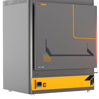
Muffle Furnace
Laboratory Drying Oven

Additional Info

Ongoing Projects:

  • “Assessing glacier retreat and links between increasing landslide and channel erosion in High Mountain Asia”. Funded by Science & Engineering Research Board. September 2022- September 2024 (PI).
  • “Modelling and Predicting the Hydro Meteorological Disasters in Indian Himalayas”. Funded by Transformational and Advanced Research in Sciences (STARS), Ministry of Education. July 2023- July 2026 (CoPI).
  • “A novel framework for water quality prediction based on socio-economic indicators, satellite imaging and machine learning”. Kurta Water and Environment Foundation, japan. September 2023 – September 2024 (PI).

Gallery

News


NIL