Office Address

  • Department of Earth and Environmental Sciences IISER Campus, Knowledge city Sector 81, SAS Nagar (Mohali) P.O Manauli India. PIN 140306
  • headees@iisermohali.ac.in

Social List

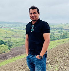
Chandrakanta Ojha

Assistant Professor
  • Research Group: Satellite Remote Sensing
  • Office: AB1, 5F1
  • Email: chandrakanta[at]iisermohali.ac.in

About

Dr. Chandrakanta Ojha is an Assistant Professor in the Department of Earth and Environmental Sciences at IISER Mohali. He has a Ph.D. in Civil and Environmental Engineering from the University of Rome, Italy, MTech from the IIT Bombay in Resource Engineering, and MSc in Physics from Delhi University. Earlier, he worked as a research fellow at IREA-CNR, Italy, postdoctoral researcher at the Arizona State University in the USA, and a scientist in Geoscience-Australia under the Australian government. His primary research focused on developing advanced multi-temporal SAR interferometry (InSAR) algorithms and exploring InSAR capability by integrating with other remote sensing data for monitoring various natural and anthropogenic hazard phenomena.

Social Media Links

ResearchGate: https://www.researchgate.net/profile/Chandrakanta-Ojha
Twitter: https://twitter.com/chandraphyctc
Research

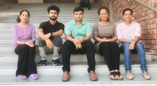
Our group focuses on interdisciplinary research covering a broad spectrum of satellite remote sensing technology and its application for Earth observation related to natural and anthropocentric processes. This includes hydrological and geophysical processes involving glacier dynamics studies, landslides, land subsidence, groundwater studies, flood mapping, infrastructure monitoring, land cover classification, etc.

People

Name Role Email ID Profile Photo
Shivam Chawal Junior Research Fellow
Sona Sharma Junior Research Fellow
Sharmistha Sonowal Junior Research Fellow
Aparna R MS Thesis

Alumni

Name Role Email ID Profile Photo
Pooja Dhayal MS Thesis-2023
Abhirami S A MS Thesis-2023
Ravi Kumar MS Thesis-2023

Publications

  • L.Ohenhen, M. Shirzaei, C. Ojha, M. L. Kirwan, “Hidden vulnerability of US Atlantic coast to sea-level rise due to vertical land motion”, Nature Communication, 14, 2038 (2023) https://doi.org/10.1038/s41467-023-37853-7
  • S. Sherpa, M. Shirzaei, C. Ojha, “Disruptive Role of Vertical Land Motion in Future Assessments of Climate Change-Driven Sea-Level Rise and Coastal Flooding Hazards in the Chesapeake Bay”, JGR-Solid Earth, April 2023, volume 128, Issue4, e2022JB025993. https://doi.org/10.1029/2022JB025993
  • J.C. McCubbine, Z. Du, C. Ojha, M.C. Garthwaite, N.J. Brown, “InSAR processing over the Great Artesian Basin and analysis over the western Eromanga Basin and northern Surat Basin” Record 2022/029 Geoscience Australia, Canberra. http://dx.doi.org/10.11636/Record.2022.029
  • S. Tung, M. Shirzaei, C. Ojha, A. Pepe, Z. Liu, “Structural controls over the rupture and aftershocks of the 2019 Ridgecrest earthquake one sequence investigated by high-fidelity elastic models of velocity structures” JGR-Solid Earth, 2021, 126, Issue7, https://doi.org/10.1029/2020JB021124.
  • M. Shirzaei, M. Khoshmanesh, C. Ojha, S. Werth, H. Kerner, G. Carlson, S. Futi Sherpa, G. Zhai, J.C. Lee, “Persistent impact of compound extremes on crop loss in U.S. Midwest,” Weather and Climate Extremes, 2021, 34, DOI: 10.1016/j.wace.2021.100392
  • C. Ojha, M. Shirzaei, S. Werth, “Recovery of aquifer-systems in Southwest US following 2012-2015 drought: evidence from InSAR, GRACE and groundwater level data”, Journal of Hydrology, 2020, Volume 587, DOI: https://doi.org/10.1016/j.jhydrol.2020.124943
  • E. Blackwell, M. Shirzaei, C. Ojha, S. Werth, “Tracking California’s sinking coast from space: implications for relative sea-level rise SAR interferometry for measuring coastal subsidence,” Science-Advance, 31 Jul 2020, Vol. 6, no. 31, eaba4551, DOI: 10.1126/sciadv.aba4551
  • G. Carlson, M. Shirzaei, S. Werth, C. Ojha, “Subsidence-Derived Volumetric Strain Models for Mapping Extensional Fissures and Constraining Rock Mechanical Properties in the San Joaquin Valley, California,” JGR-Solid Earth, Volume125, Issue9, August 2020, DOI: 10.1029/2020JB019980
  • S. Sherpa, M. Shirzaei, and C. Ojha, S. Werth, R. Hostache, “Probabilistic Mapping of August 2018 Flood of Kerala, India, Using Space-borne Synthetic Aperture Radar”, IEEE JSTARS, Vol. 13, pp. 896-913, 2020, DOI: 10.1109/JSTARS.2020.2970337
  • G. Carlson, M. Shirzaei, G. Zhai, S. Werth, C. Ojha, “Seasonal and Long‐Term Groundwater Unloading in the Central Valley Modifies Crustal Stress,” JGR-Solid Earth, 125, 2020, DOI: https://doi.org/10.1029/2019JB018490
  • C. Ojha, A. Fusco, M. Pinto, “Interferometric SAR Phase Denoising Using Proximity Based K-SVD Technique,” Sensors, 2019, 19, 2684. DOI: https://doi.org/10.3390/s19122684
  • C. Ojha, S. Werth, M. Shirzaei, “Groundwater loss and aquifer-system compaction in San Joaquin Valley during 2012 – 2015 drought”, JGR-Solid Earth, 2019, 124(3), pp. 3127-3143. DOI: https://doi.org/10.1029/2018JB016083.
  • M. Shirzaei, C. Ojha, S. Werth, G. Carlson, E. Vivoni, “Comment on Short-lived pause in Central California subsidence after heavy winter precipitation of 2017 by K. D. Murray and R. B. Lohman”, Science Advance, 2019, Vol. 5, no. 6, eaav803. DOI: 10.1126/sciadv.aav8038
  • C. Ojha, M. Shirzaei, S. Werth, D. Argus, T. Farr, “Sustained groundwater loss in California’s Central Valley exacerbated by intense drought periods,” Water Resources Research, 2018, 54 (7), pp. 4449-4460, DOI: https://doi.org/10.1029/2017WR022250.
  • S. Scifoni, M. Bonano, M. Marsella, A. Sonnessa, V. Tagliafierro, M. Manunta, R. Lanari, C. Ojha, and M. Sciotti, “On the joint exploitation of long-term DInSAR time series and geological information for the investigation of ground settlements in the city of Roma (Italy),” Remote Sensing of Environment, Vol. 182, pp. 113-127, 2016, DOI: https://doi.org/10.1016/j.rse.2016.04.017
  • C. Ojha, M. Manunta, R. Lanari, and A. Pepe, “The Constrained-Network Propagation (C-NetP) Technique to Improve SBAS-DInSAR Deformation Time-Series Retrieval,” in IEEE Journal of Selected Topics in Applied Earth Observations and Remote Sensing, 2015, DOI: 10.1109/JSTARS.2015.2482358.
  • E. Sansosti, M. Manunta, F. Casu, M. Bonano, C. Ojha, M. Marsella, and R. Lanari, “Radar remote sensing from space for surface deformation analysis: present and future opportunities from the new SAR sensor generation,” Rend. Lincei, Springer, Vol. 26, no. 1, pp. 75–84, 2015, DOI: 10.1007/s12210-015-0440-3
  • Book chapter
  • M. Corsetti, M. Manunta, M. Marsella, S. Scifoni, A. Sonnessa, C. Ojha, “Satellite Techniques: new perspectives for the monitoring of dams,” in Engineering Geology for Society and Territory-Vol 5., Springer International Publishing, pp. 989-993, 2015, DOI: 10.1007/978-3-319-09048-1_190

Courses

  • EES403-Remote Sensing and GIS
  • EES642-Principles of Microwave Remote Sensing
  • IDC101-Introduction to Computers

Lab Facilities

NIL

Additional Info

NIL

Gallery

NIL